Djibouti
On the world map
There is no oil, little water but plenty of stones, sand, and immemorial landscapes that date back to the dawn of time. Fate has placed Djibouti, a small country (23,000 km2) that has been independent for forty-five years, at the entrance to the Bab el-Mendeb Strait, a strategic crossroads on one of the world’s busiest trade routes.
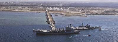
Leveraging its geography, Djibouti has become a major port and logistics hub in just over two decades. It is also an essential transit point between Asia, Africa and Europe and the gateway to Ethiopia, Somaliland, Somalia, South Sudan (and its oil wealth) and Central Africa. With so little hard power, the country has become an island of stability in a turbulent region. Strategically, it is a pivotal point between China (which has invested heavily here) and the rest of the world. Djibouti successfully maintains a delicate balancing act between Washington and Beijing at a time when rivalry between the two superpowers is heating up. Large Chinese, American and French bases, the European Union’s anti-piracy forces (Operation Atalanta) and Japanese and German facilities coexist, attesting to its skillful diplomacy. And there is talk of building a satellite launch site soon. Djibouti can rely on a particularly dynamic diaspora connected to all the Somali-speaking populations of the world, which sees it as an ideal place for gathering and dialogue while managing a complex regional and economic context and facing climate change. Djibouti may be a "small nation" in the UN official terminology, but it does matters on the world map.